
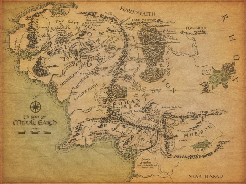
A map of Middle-earth filled with annotations by JRR Tolkien has been acquired by the Bodleian Library, Oxford. A map that reminds generations of fans of the greatest fantasies ever created has been added to the largest collection of material related to the author's work, including manuscripts of The Hobbit and The Lord of the Rings.
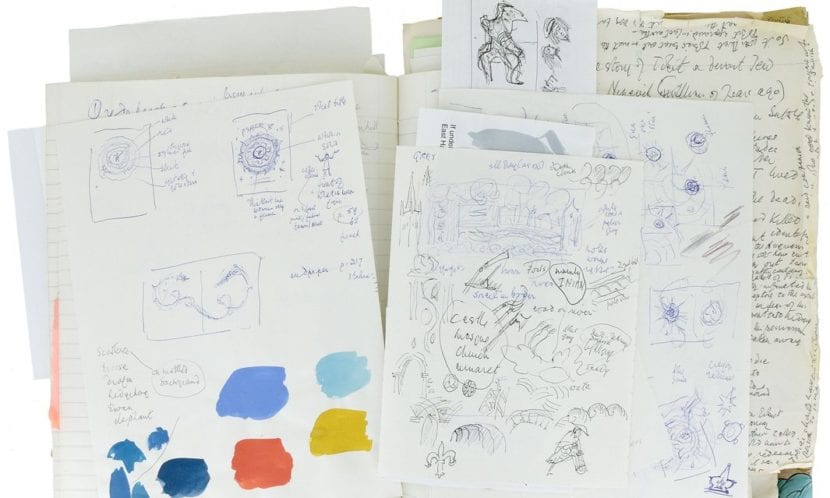
The author's annotations, written in green ink and pencil, show what was the creation of the world in Tolkien's mind:
"Hobbiton occupies approximately the latitude of Oxford."
The geographical points were destined to give Pauline Baynes, the artist who was illustrating the map in his world, the climate guidelines for the various key sites of history.
“The Minas Tirith have a latitude of Ravenna (but it is 900 miles east of Hobbiton, closer to Belgrade). The inner part of the map (1400 miles) is roughly the latitude of Jerusalem. "
"Elephants appear in the great battle outside Minas Tirith (as they did in Italy under Pyrrhus), but they will be in one place in the white stables in Harad - camels too."
Pauline Baynes was the only illustrator approved by Tolkien and also introduced him to his Oxford friend CSLewis, whom he helped illustrate all of his Narnia books. Tolkien and Lewis were members of the Inklings group of Oxford authors and scholars. They used to meet and read the latest work in a pub called "Eagle and Child."
The map poster was published in 1970 and was bordered with the first illustrations of Tolkien's characters, But was based on the folding map from the first volumes of the 1954 trilogy from The Lord of the Rings, which had been drawn by Tokien's son Christopher, following his father's meticulous instructions.
Pauline Baynes tore the map from her own copy and brought it to Tolkien, who covered with notes including many additional place names that do not appear in the book. Since most of the names were in their invented elven language, spoken fluently by the many fans that the story garnered, it was necessary to introduce the translation, and description, of some:
"Eryn Vorn [= Black Forest] a region of the dark forest with trees [pine?]"
He also indicated the colors of the ships and the emblems on their sails.
"Elves: small ships, white or gray ... Gondor, The Black and Silver ships ... The Corsairs had red sails with a star or black eye."
Pauline Baynes died in 2008, but the map was not rediscovered until last year, tucked into a book that she had kept. Oxford's Blackwells bookstore put it up for sale and valued it at £ 60000. The Bodleian was able to purchase it thanks to grants from the V&A and friends of the library.
Chris Fletcher, the keeper of the special collections that make up the Bodleian, said that maps were central to Tolkien's narrative And that it would have been a disappointment if it had ended up abroad or in a private collection.
"This particular map provides a glimpse into the creative process that produced some of the earliest images of Middle-earth, with which many of us are already familiar. We are delighted to have been able to purchase this map. It would have been a shame if this map had ended up abroad or in a private collection. "
"Tolkien spent most of his adult life in the city and was thinking clearly about geographic importance as can be seen from the elements that make up the map."
Middle-earth is not just a world that appears in a few books, but a world that the author himself glimpsed in his mind, created to perfection with great detail so that even today more is discovered about it. A true world that surpasses the conventional illustrations that accompany many books today.